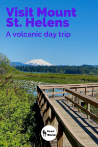
In this article I’ll provide a great day-trip itinerary to enjoy the Mount St. Helens National Volcanic Monument from Portland, Seattle or points in between.
Mother Nature wakes up
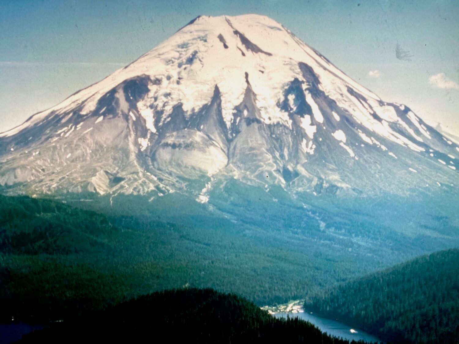
For most of the 20th century, Mount St. Helens was a quintessential icon of raw Pacific Northwest beauty. Climbers regularly summited her 9,360 foot peak and an assortment of recreation activities from boating to hiking were enjoyed by enthusiastic visitors from near and far. Her crown of snow trailed down to a thick skirt of old growth fir forests, and snow runoff fed numerous rivers and lakes — most famously Spirit Lake. It was the iconic picture of pristine nature. Until…
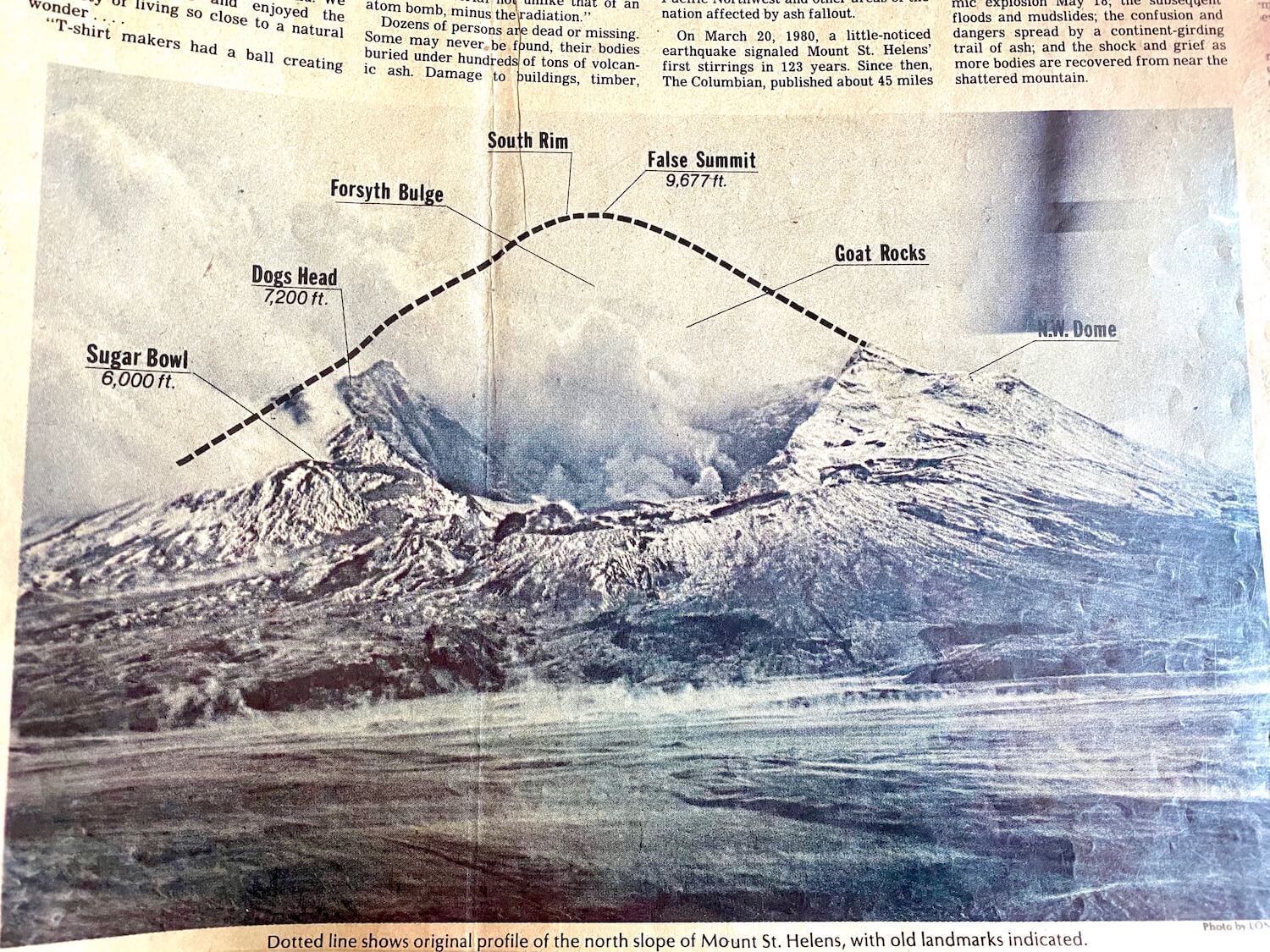
40 years ago, in the spring of 1980, she started to wake up and rumble. At 8:32am on May 18, 1980, a 5.1 magnitude earthquake initiated a series of events that would include the largest landslide ever recorded in the world, and a blast pushing 1300 vertical feet of mountain into a 13 mile high plume of ash and rock. 57 souls perished in the catastrophic series of events and almost 200 people were rescued by helicopter crews.
The eruption feels very personal to me since I was seven at the time, only 40 miles away from the center of the blast, in Scappoose, Oregon. I write more about this experience in my blog post Where were you when the volcano blew? Once you have finished this article, my favorite collection of photos of the event is in The Atlantic.
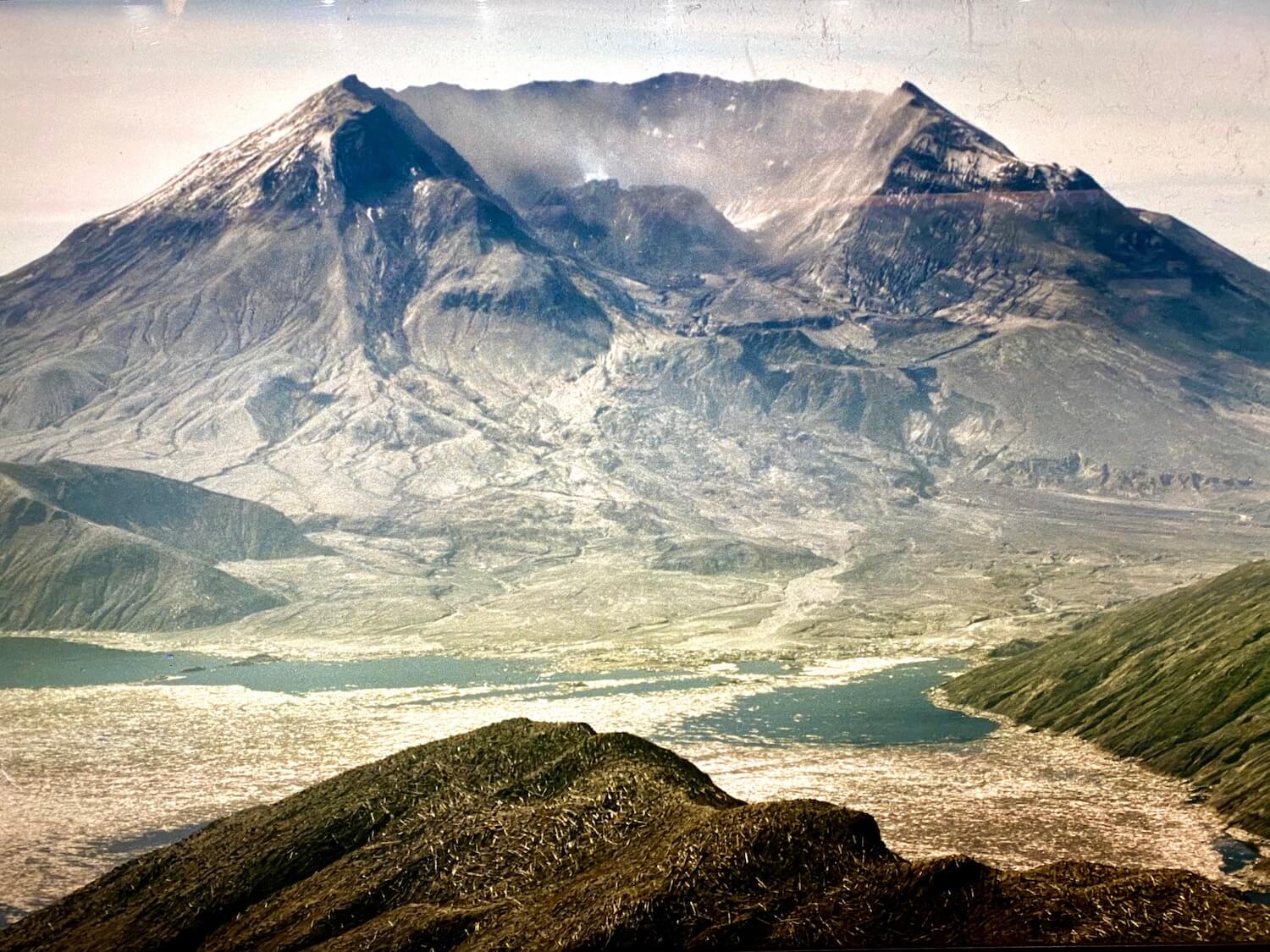
The scene for many years after the famous eruption resembled photos of the moon. No apparent life for miles — just volcanic ash everywhere. The nearby mountain lakes were filled with a medley of debris including a patchwork of trees, mud and all kinds of other organic matter. It seemed like life would never return.
Mount St. Helens before and after
40 years later — Life returns on Mount St. Helens
In only a matter of years, the lakes cleared up, aided by millions of small bacteria. Trees were planted in some areas while other parts of the topography welcomed volunteer seeds of quick-growing trees like alders. Pocket gophers mixed the ash and soil, prairie lupine sprouted from roots in the ground, and sitka willow rooted along streams — all early heroes in a new, emerging world.
Aside from shoveling her ash from our deck, my relationship with Mt. St. Helens developed later in the 1990’s. I’ve enjoyed so many varied experiences — hiking the dusty blast zone ridge trail, exploring the Ape Caves, camping near Cougar, riding in a helicopter over the ridges of blasted trees, and climbing to the summit of the crater rim in the June snow. I’ve grown to love the mountain and surrounding areas, in this newly emerging recreation wonderland.
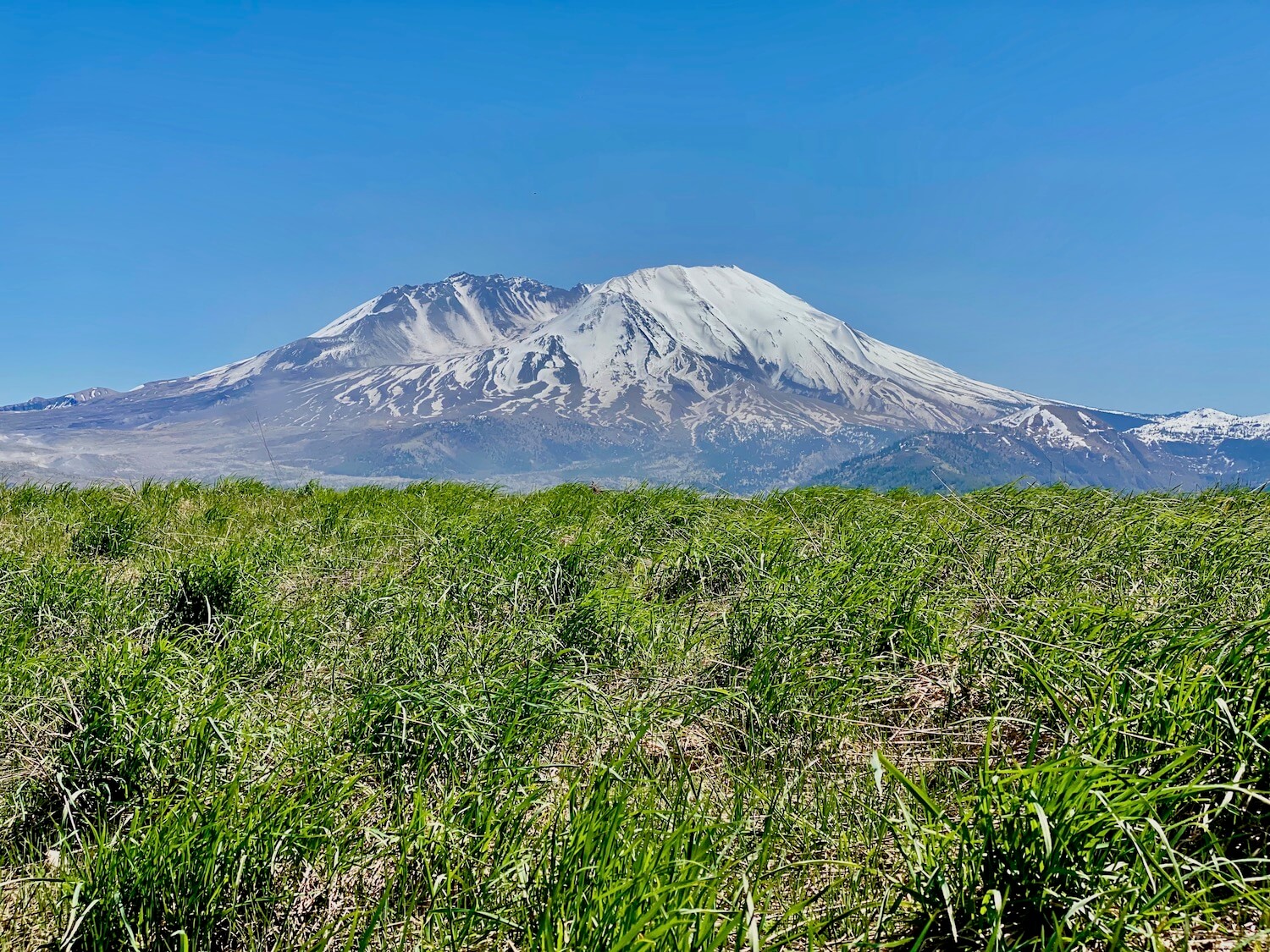
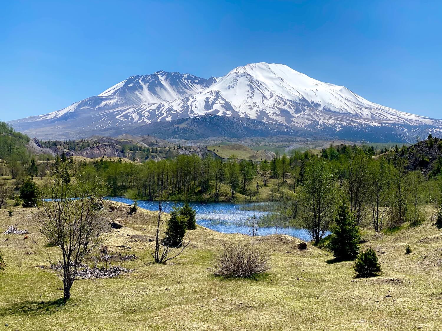
I recently returned to Mt. St. Helens, for a day trip from my home in Seattle, and felt a rush of joy gazing at the snow-covered crater — a vibrant carpet of plant life flowing in every direction as we rounded the many curves along the Spirit Lake Highway. Truly inspiring that 40 years later the landscape is a lush color of green, everywhere.
Mount St. Helens day trip
The only constant thing on Mt. St. Helens is change, making each visit truly unique to that particular moment. While the moon scapes once present over a majority of the landscape are quickly filling in with plant life, there are many ways to take in the history and stunning views, even today.
Visiting Mt. St. Helens is easily done in a day trip from most places in Western Oregon and Washington — and a perfect “must add” activity if traveling between Seattle and Portland. I talk more about this option in another article about the Seattle to Portland drive on Interstate 5.
This post will focus on enjoying the beautiful Spirit Lake Highway #504, which begins at Castle Rock exit #49, along Interstate 5, and meanders mountain curves all the way to the Johnston Ridge Observatory — the volcano’s greatest hits. The amount of time really depends on how many stops, whether a hike is in the itinerary and, of course, avoiding hangry scenarios.
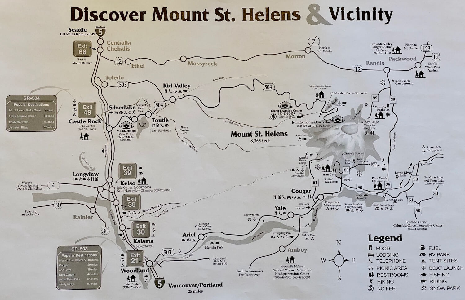
Map of Mount St. Helens Volcanic Monument
First of all, maps are important to help learn the layout of the land. A great Forest Service Map is available to download, just below, while a less scientific version is included as a photo, also below. For a day trip the photo is sufficient in outlining the route and visitor options. Depending on the carrier (Verizon the best, T-Mobile worst), cell service wanes a few miles past Kid Valley, so be sure to have some kind of map readily available. It’s difficult to get lost, because there is simply one main road.
Get an early start to the day
For best results in the Summer, leave as early as possible in the morning to beat the afternoon heat and crowds. This will also help avoid traffic and ensure the ability to visit as many features as energy allows. I also find that even with best intentions to manage time, leaving too late in the day limits the momentum to see and do everything on the docket.
From either Portland or Seattle, turn off Interstate 5 at exit #49, for Castle Rock. This is a great location for food and fuel, if needed.
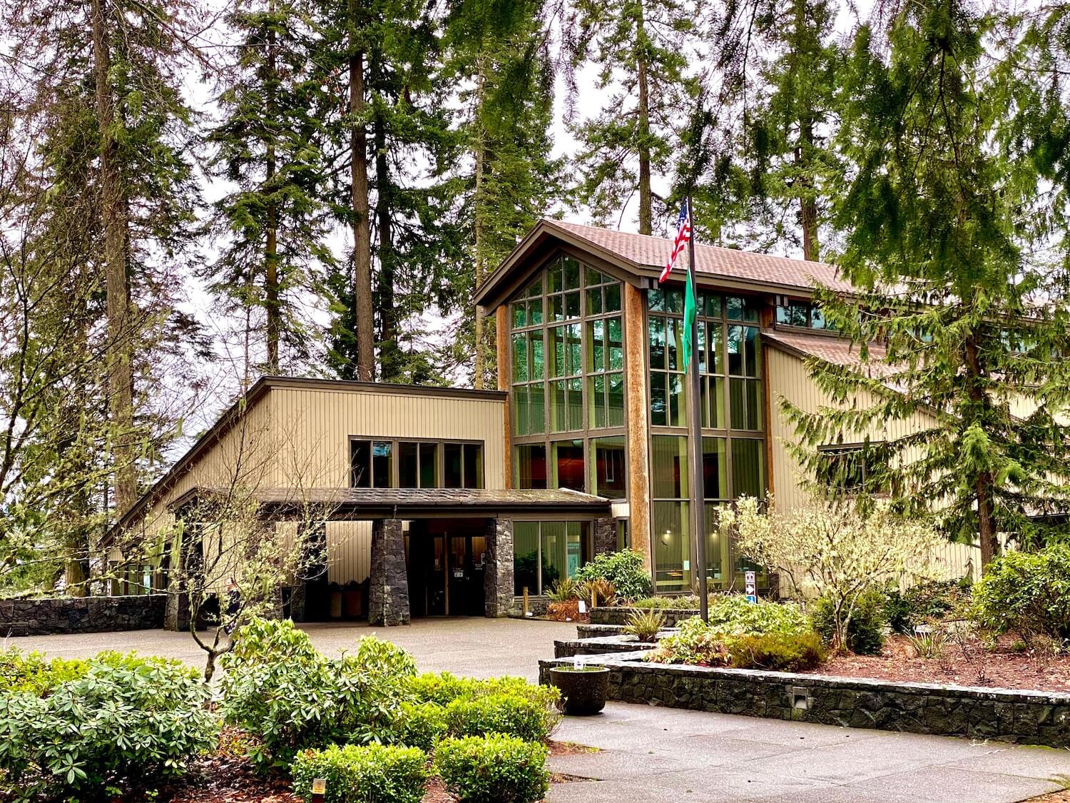
Mount St. Helens Visitor Center
About five miles from the freeway, stop to stretch legs and check out a well-curated interpretive center. When open, this must-see visitor center frames the May 18, 1980 eruption with key information, photos and a chilling movie that brings the series of events alive. The exhibits offer a glance into Pacific Northwest life in 1980 and a before and after framework great for all ages.
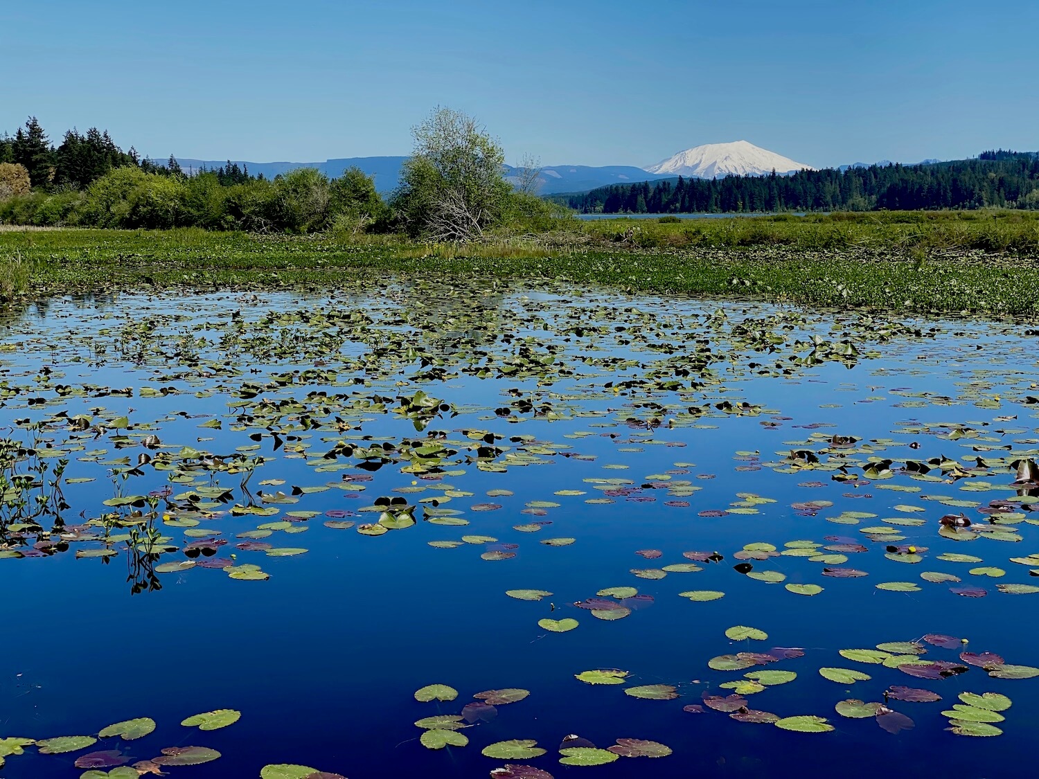
From the visitor center be sure to venture out to peaceful, nature-steeped Silver Lake (photo below). Paths in front of the visitor center lead to a series of boardwalks hovering inches above the marshy part of the lake. In the rainy Winter season a brooding mood exists with gray skies and droplets of rain and with the brighter seasons come an eruption of lily pads, abundant greenery and direct views of Mt. St. Helens.
The lake is also adjacent to Seaquest State Park, which is currently open to the public. Even if the Visitor Center is closed it’s worth some time to wander around the easy walk, maybe have a picnic in the watery ecosystem, and ponder life before and during the big eruption.
Spirit Lake Highway 504
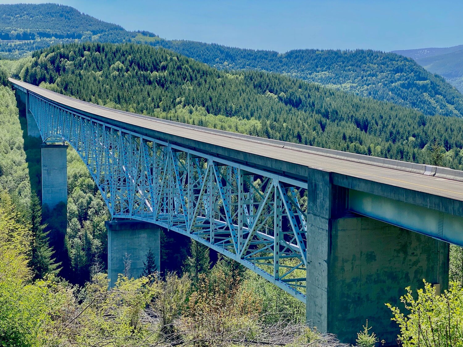
From Silver Lake and the visitor center continue east along Spirit Lake Highway 504 past the modest towns of Toutle and Kid Valley. The road winds through new forests of timber planted after the eruption and about 11 miles past Kid Valley look for a place to turn off the road just before Hoffstadt Creek Bridge (photo below).
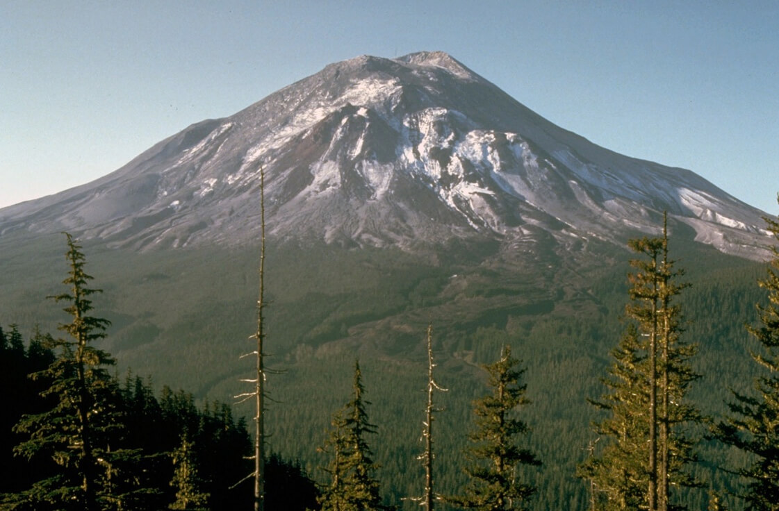
Read up on the placards displayed there and get a great view of one of the many expanses re-built to usher visitors to the Volcanic National Monument. Of note, this photo below shows the start of the blast zone, which was devastated by the boom of atomic bomb-like energy. This view in 1980 would’ve revealed a post apocalyptic looking landscape — complete with millions of trees blown over, singed and covered in ash.
Roadside Viewpoints
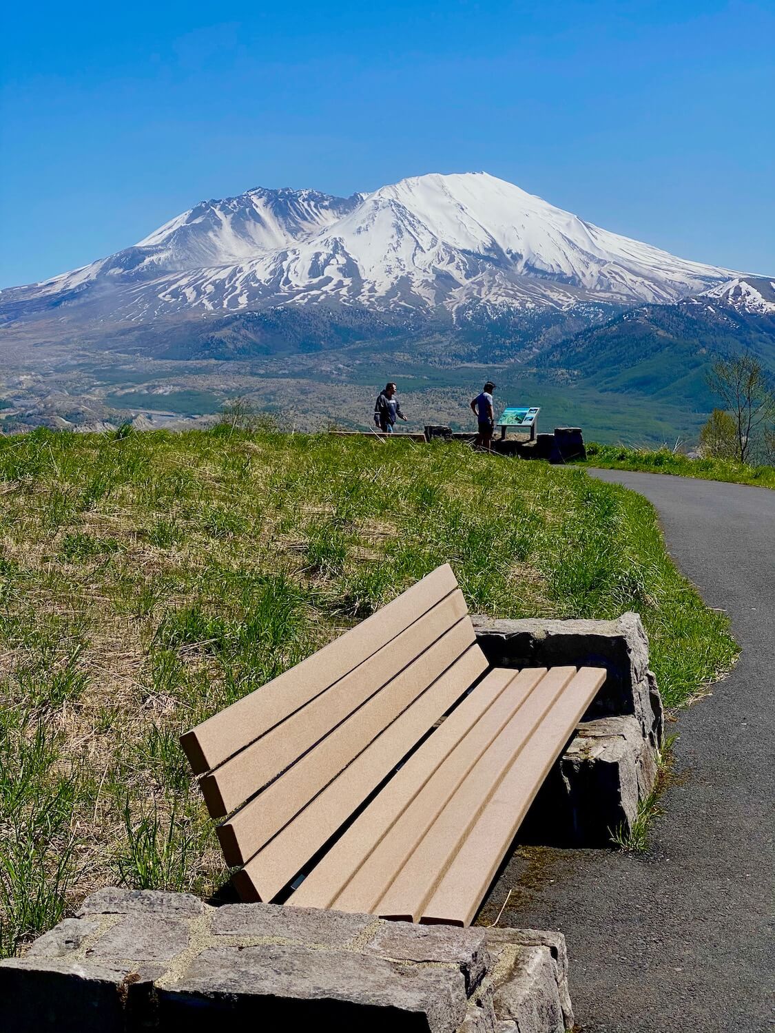
The Elk Rock Viewpoint commands a view of Mt. St. Helens and the Toutle River Valley from a high perch of 3,760 feet and ushers in the beginning of the Volcanic Monument. I suggest continuing on and stopping here on the return trip down the mountain. Wind around abundant views of fir trees and green covered everything and enjoy the sweeping views — but keep eyes on the road! Pull off the road at the Castle Lake Viewpoint (photo below) and take in the vast blast zone landscape leading to the sleeping giant. I like this stop because there is a grassy knoll and picnic area to stretch legs and enjoy a snack in the open mountain air.
National Volcanic Monument learning areas
There are four interpretive centers on the Spirit Lake Highway. The most important would be the Mt. St. Helens Visitor Center already mentioned above. However, the three additional stops are all worthwhile (at the time of this writing 5/18/20 they are not yet open).
Forest Learning Center
This free exhibit is the result of an unusual partnership between Washington State Department of Transportation, forestry giant Weyerhaeuser and the Rocky Mountain Elk Foundation. The learning center is perched upon a hill in the official “blast zone” and brings to life the wonderful world of trees and other plant and animal life in the vast green spaces of the Pacific Northwest. The focus is on forestry and the salvage, recovery, and reforestation of the land in and around the blast zone. There are some fun Elk exhibits and since this is free to the public, makes for an excellent stop.
Science and Learning Center at Coldwater
During the winter months when Johnston Ridge is closed, this visitor center remains open to the public — highlighting the science of the eruption and natural recuperation over the last 40 years. The view from this complex peers over Coldwater Lake below toward the quiet volcano, and trailheads lead to the pristine lake and onward — for day use only.
Johnston Ridge Observatory
This complex oozes science and is named after a volcanologist monitoring the mountain at a forest service camp on the ridge. David Johnston died instantly in the eruption. The visitor center focuses on geology and observatory science and is the location of one of the best views into the crater of the mountain. For a great hike, follow the trailhead east along the rim of the ridge to a vantage point that opens up to inspiring views of Spirit Lake — entirely reengineered during the eruption. Part of one of the science exhibits in the photo below helps illustrate the massive changes caused by the eruption, in particular from this vantage point.
Hiking Mount St. Helens
Hiking Mount St. Helens is a treat — the National Monument area is monitored and protected in a way that allows valuable research to continue on how nature rebuilds and moves on without assistance from humans. 40 years later, abundant green covers much of the land that was once smoldering ash glazed over the razed land like the foam on a lemon meringue pie. Much of this green comes from early forming moss that makes a dense ground cover.
The Hummocks trail parking lot is easy to find, since it’s the last place open until the barricade sealing off further travel on the Highway to Johnston Ridge Observatory. From the trailhead, the Hummocks hike is an easy mile in and mile out. Witness the effects of erosion as the ash piles caved in, creating space for lakes to form and with them, whole new ecosystems encouraging animal and plant life. The trail comes to a crossroads at a perfect viewpoint of a reclaimed lake and stunning crater views.
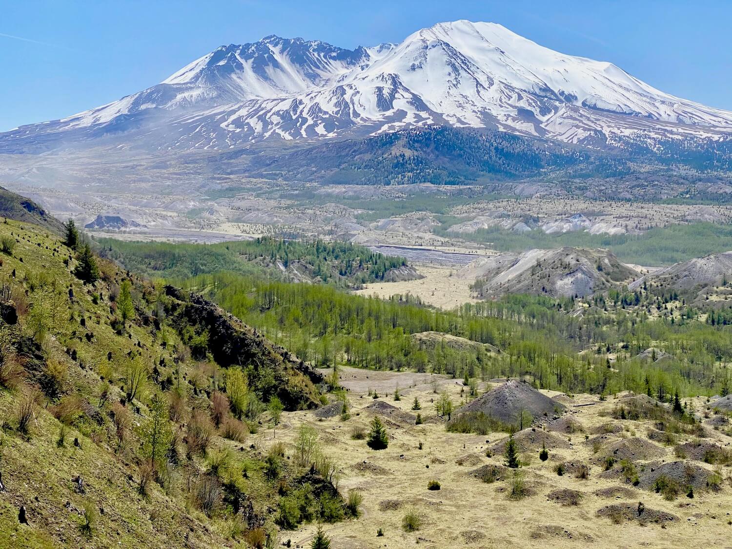
From here there is a longer option to take the 8 mile round-trip hike up to Loowit Viewpoint. The terrain is steep and wind-blown and magically rides along the rim overlooking the North Fork of the Toutle River and the main blast/landslide zone that still offers reminders, not yet completely greened over, of the earth altering power of nature (photo below).
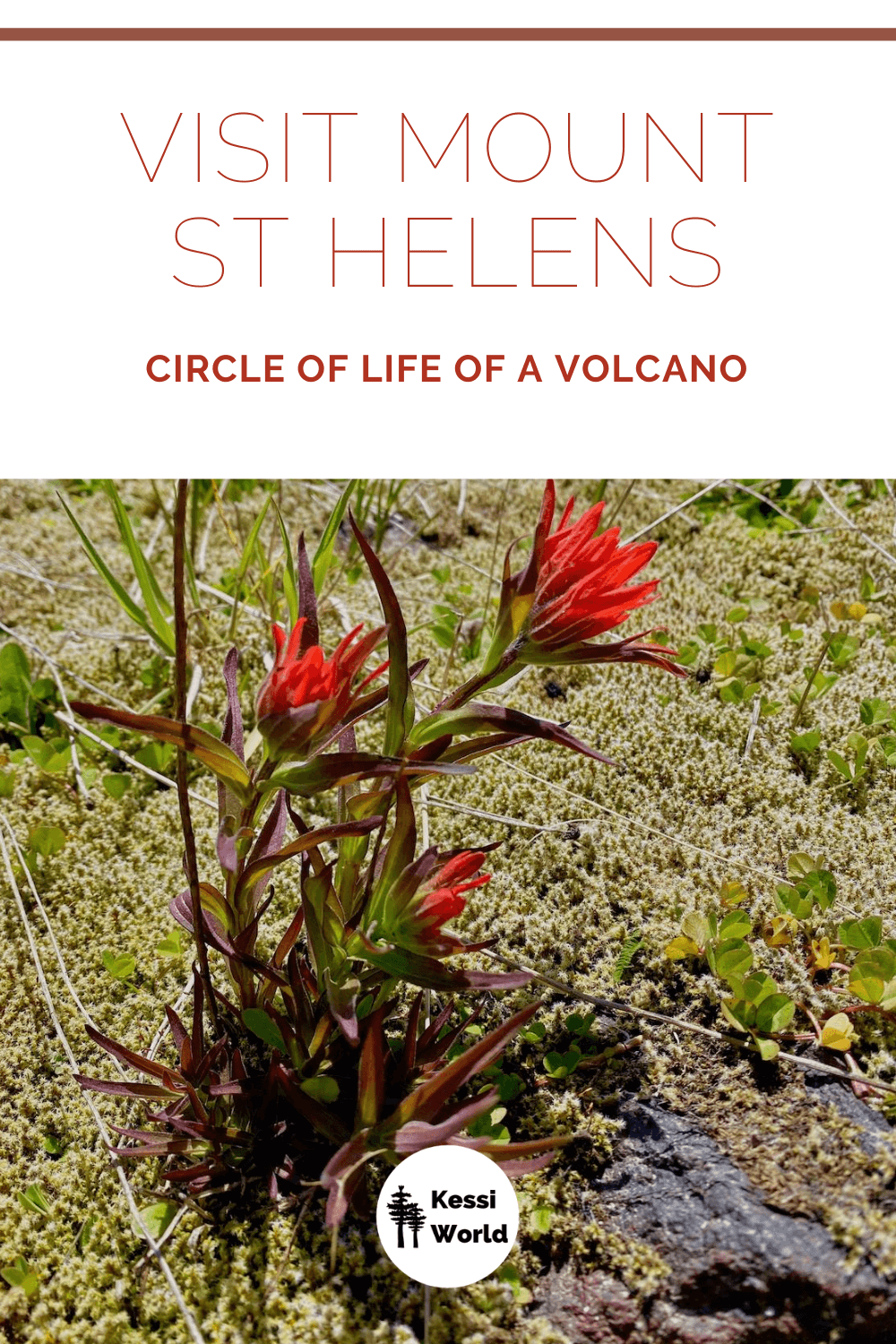
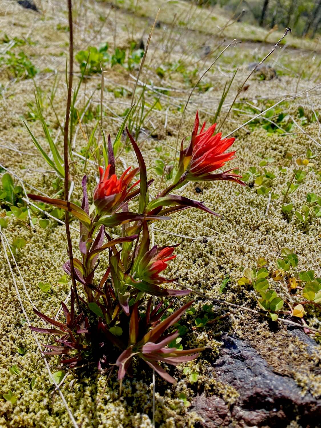
With the passing of each year, more plants and trees begin to sprout, expanding the carpet of green life throughout the former destruction zone — seemingly left uninhabitable 40 years ago. Hiking the environs, especially in the late Spring, is a great way to see evidence of the resilience of nature. Mosses and strawberries seemed to adjust first, followed by plants like harsh Indian paintbrush (photo below) and quick-growing alder trees. A great resource for plants is this Wildflower Search specific to Mount St. Helens area.
While there is a lot of green now, the trees haven’t grown high enough to fend off the sun, so be sure to wear sunscreen and take protective gear and lots of water. Also important to know that this area is sensitive to incoming seeds of potentially invasive plant species, so no pets or bicycles are allowed off the main road.
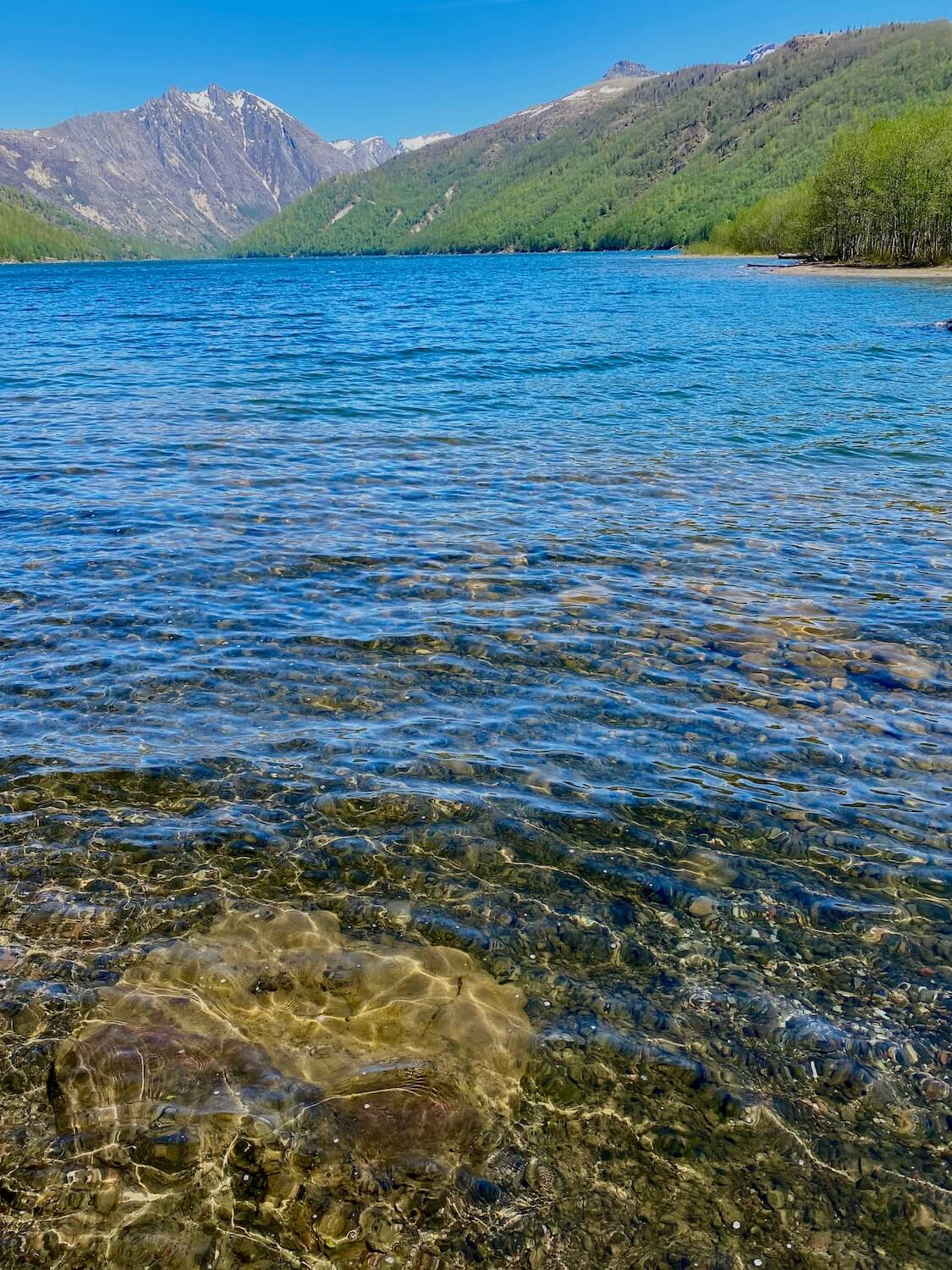
Hummocks is the only parking lot currently open, but the entrance to Coldwater Recreation Area (photo below) is just a quick jaunt across the road. A short hike to the pristine mountain lake opens up to fishing and picnic areas for day use and the Birth of a Lake Interpretive Trail winds along the bank of the lake — complete with views of the top of Mt. St. Helens while clear water lightly laps up onto the shore.
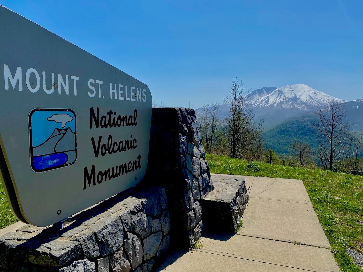
With some nature under the belt and a better understanding of the blast zone of the May 18 eruption, it’s time to start the return trip. Wind back on the highway towards Castle Rock and stop at the Elk Rock Viewpoint for one final gaze at the mountain and surrounding area. The Monument sign (photo below) makes for great group shots and selfies.
The spirit of Mount St. Helens lives on
Mt. St. Helens has enjoyed 40 years to grow into her new environment and while the blasted-over fir trees and moon scape are filled in with new shades of green the spirit of nature constantly in movement lives on. Life bursts from all directions, reminding us that, just like Mt. St. Helens, we can survive the blast and live to rebuild, regrow, and rejoice in renewed beginnings.
If you go — Helpful planning tips
Social Distancing
The Gifford-Pinchot National Forest is not part of the State Park or National Park system and the land is managed by the Forestry Service, making the rules around social distancing and opening of parks a bit more nuanced. It’s a good idea to check the official website for updated information. At the time of this writing (May 18, 2020) the Hummocks Trail and Coldwater Recreation Area are open for day use.
Mount St. Helens weather
While Mt. St. Helens might seem like a warm spot, being a volcano and all, remember this is a mountain that still has quite an elevation gain in the Cascade Mountains. Snow is on the side of the roads through May and June. Like anywhere in the Pacific Northwest, always be prepared with layers to wear in case of unexpected rain storms. If plans include any kind of hiking, there will likely be areas without any protection from the wind, so clothing to break the chill is important.
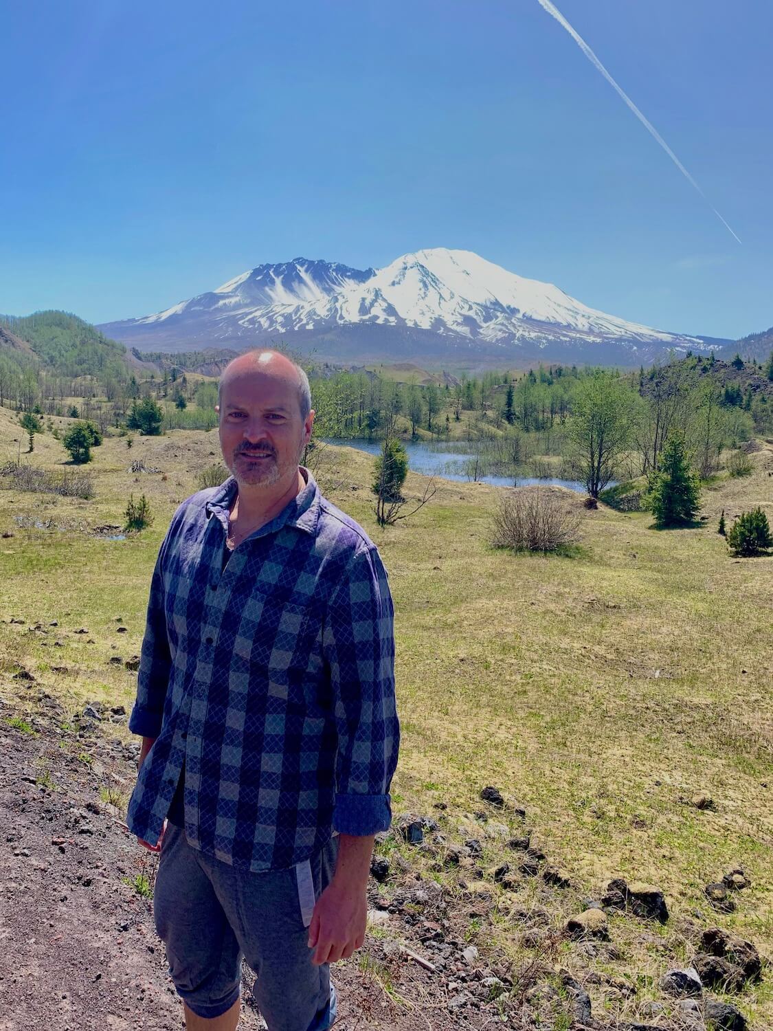
The summer season can get surprisingly hot in the afternoon sun. Since the tall old-growth timber disintegrated or blew over like match-sticks, there isn’t much shade (see my red forehead in photo below), so be sure to apply sunscreen and take plenty of water if hiking.
Planning a drive to Mount St. Helens
Seattle to Mount St. Helens
Regardless of the focus for the day trip, it’s best to get an early start to a day at the volcano. Reverse traffic from Seattle and Tacoma helps make the trip go faster and puts arrival before things get busy at the main attractions. A few distances from downtown Seattle might help planning:
- Seattle to Mt. St. Helens Visitor Center, near Castle Rock Exit #49: 121 miles / 2 hours each direction
- Seattle to Johnston Ridge Observatory via Spirit Lake Memorial Highway 504: 155 miles / 2:45 hours each direction
Portland to Mount St. Helens
Portland is actually much closer to Mt. St. Helens verses Seattle — in fact the forest service office in Vancouver was the “Houston Control” during the 1980 eruption.
- Portland to Mt. St. Helens Visitor Center, near Castle Rock Exit #49: 70 miles / 1 hour each direction
- Portland to Johnston Ridge Observatory via Spirit Lake Memorial Highway 504: 110 miles / 1:45 hours each direction
Road trip between Portland and Seattle via Spirit Lake
Most people visit Mount St. Helens from the West via the Spirit Lake Memorial Highway because of the proximity to I-5. I write about this in my article, Seattle to Portland road trip. However, an awesome option (closed in Winter) is to explore the forest roads that traverse North/South on the East side of the Volcanic Monument. This routing includes some interesting attractions like the Trail of Two Forests and Ape Caves, along with stunning views of Spirit Lake. I write all about it in another article, Spirit Lake road trip — the secret side of Mount St. Helens.
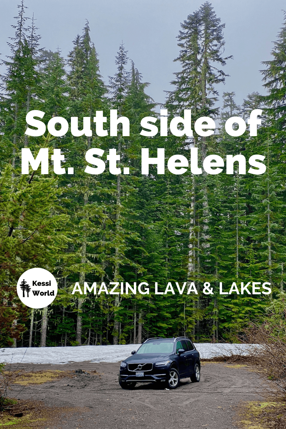
Amazing lava and lakes — visit the south side of Mount St. Helens
If time permits consider overnighting in nearby Kalama and taking another day to explore the less destroyed south side of the mountain, complete with pristine mountain lakes, lava tubes, vast fir forests and alpine hikes. Click the photo below or HERE for more information.